engraving
Details
Description
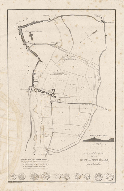
Engraving, 253 x 391 mm (plate size). Surveyed and drawn by T. Godman, engraved by I. Lambert, the coins by H. Moses.
Plan of the site of the Roman city of Verulamium, also including St Michael's, Fishpool Street and St Albans Abbey, from a survey done in 1814. Across the bottom of the page are illustrations of five Iron Age coins minted at the Iron Age capital of Verlamio, with details of the collections in which they were held at that time.
Plan of the site of the Roman city of Verulamium, also including St Michael's, Fishpool Street and St Albans Abbey, from a survey done in 1814. Across the bottom of the page are illustrations of five Iron Age coins minted at the Iron Age capital of Verlamio, with details of the collections in which they were held at that time.
Name/Title
'Plan of the Site of the City of Verulamium', 1814.
Media/Materials
Accession No
2008.5517
Comments
Be the first to comment.