map
Details
Description
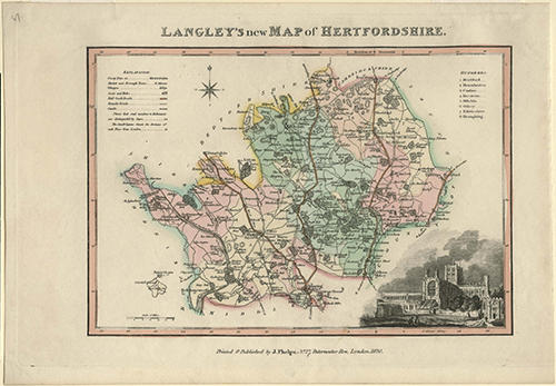
"Langley's new Map of Hertfordshire." Coloured map of Hertfordshire as it existed in 1820, with an illustration of St Albans Abbey in the bottom right hand corner. Printed and published by "J.Phelps., No. 27 Paternoster Row, London, 1820."
Name/Title
map
Media/Materials
Accession No
2005.5754
Comments
Be the first to comment.