map
Details
Description
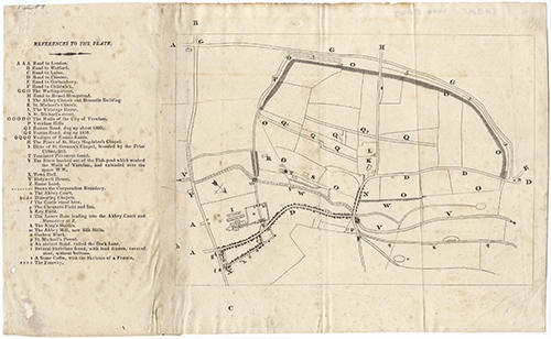
Map of St Albans with locations indicated by letters. A list of references on the left identifies the locations indicated on the map.
Since the locations listed include "Q2 Roman Road, dug up 1818", the map must date from after 1818.
Since the locations listed include "Q2 Roman Road, dug up 1818", the map must date from after 1818.
Name/Title
map
Media/Materials
Accession No
1998.5043
Comments
Be the first to comment.